
We have reached the end of week two on site, and I thought I’d give a summarised round-up of what we have been doing recently.
It’s been a great week on site, with lots of lovely sunny weather and we have really enjoyed showing off the site to the many visitors that have been coming round the site. The excavations have been going very nicely, with fairly major progress achieved across all of the areas that we are concentrating on this year.
In the broch, the team led by Ricky, have been made their way through the lowest rubble and then they came down on to a roughly paved surface, and a charcoal rich organic deposit spread across large parts of the western half of the building. It looks like this has been the uppermost occupation remains and is obviously very late use of the broch.

More mystifying has been the discovery of a very large pit-like feature in the south-eastern part of the broch interior that appears to have been back-filled with very large rubble. This pit plummets for nearly a metre in depth and has just today come on to a new different fill deposit, but we have not yet reached the bottom. It may turn out that this feature is some kind of stone-lined, or faced, feature set into the broch floor, perhaps a little like ones discovered in other brochs such as Crosskirk broch in Caithness. Our pit has been in-filled with rubble when the broch was abandoned, but only time will tell what the true nature of this feature is and what lies at its very base!

Another surprise discovery from the broch was yesterday’s little blue glass bead mentioned in Hanneke’s blog-piece. Kevin’s very sharp eyes spotted this lying on the top of our ‘red cell’ in the broch after it had been cleaned for photography. Technically, this is a ‘cobalt blue, truncated bi-conical, glass bead’, and although there are ‘native’ glass beads at this time, it appears that the nearest parallels for our bead are from Roman contexts in Britain. It’s a lovely little find and would typically date to the 1st or 2nd Century AD.

In the south-west extension that we have added to the main trench this year, I must confess that my original intention was to open up the area, do only a little work this year and plan for much more work there next season. However, from the outset, the deposits there have been so tantalising and potentially informative of the earliest plan for the Iron Age settlement that we simply couldn’t resist giving it a good bit more attention. For one thing, the SW extension appears to contain evidence of the way that the Iron Age community went to tremendous efforts to landscape the hill-slope in preparation for the construction of the broch. The natural glacial clay that is present in the trench appears to have been cut into during the Iron Age to create a substantial terrace on which the broch was constructed. This must have entailed the movement of hundreds of tons of earth and clay before even the first course of broch masonry was laid. It really strongly indicates the huge effort that was involved in the building project of the broch!
In addition, the SW extension also unexpectedly contains a large band of dark stony silts in one corner, these appear to be the upper fills of the great ditch that surrounds and encloses the Middle Iron Age period settlement. Today these fills have been coming up trumps in terms of finds as they have been yielding masses of large sherds of beautiful Iron Age pottery rims and bases. I can’t wait to see what else is in these ditch fills over the next couple of weeks!

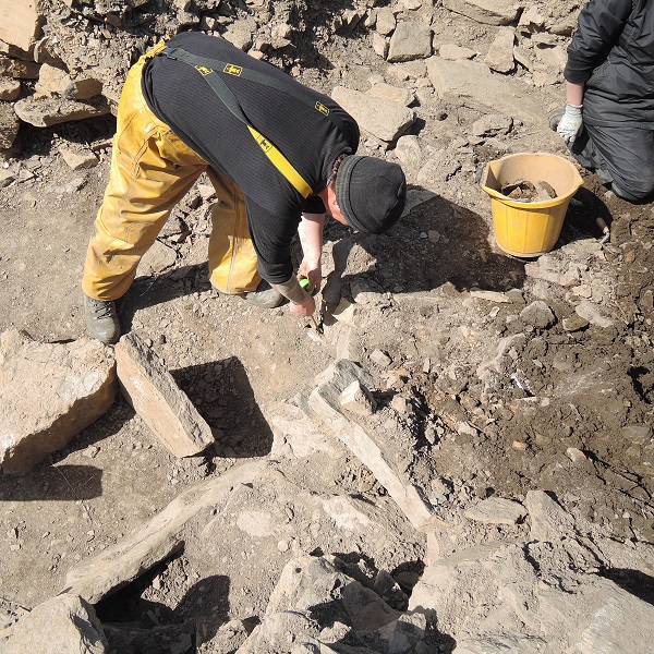
On the eastern exterior of the broch Paul, Kath and Kathryn have been working in the souterrain, Structure F. The interior soily deposits of this underground passage have been gridded-out for excavation and sampling and so far there has been some intriguing substantial animal bones found in the fill. It’s early days in here, but I think we’re going to find more very interesting deposits and hopefully also solve the mystery of the special aperture that had been created in the roof of the souterrain at its southern end when it was constructed.
Some readers may remember that when we first encountered the in situ stone roof of the souterrain, a special stone setting containing two upside-down, rotary querns had been set up on the roof, and that the holes through these were aligned to the gap in the major roof lintels beneath. We hope that this season excavation and soil chemistry might reveal whether this special aperture was used to pour something into the souterrain, and what that might be. We’ll update you as and when we begin to get a sense of what might have been going on here!
Trench Q is the area to the North and East of the broch, and we anticipate that it ought to contain extramural buildings, a village, surrounding the broch. So far, rather than any obvious sign of substantial village buildings it has been full of rubble and ashy silty soils, masses and masses of soil! There have been interesting things in this Iron Age soil; deer antlers, stone tools and pottery, etc., but no sign of building remains. It looks like they are very much more deeply buried beneath the rubble and ash.
Meanwhile, over in the eastern corner of Trench Q we have encountered an area of modern disturbance, adjacent to a modern pit that we have previously excavated. It appears that this disturbance involved a large amount of very large pieces of rubble being filled into a pit. We can see that there are some massive voids reaching down to about a 1.5 metres below the present surface of the trench. It looks as if next week we may be able to establish what this modern pit hit when it was first dug out, and it looks like it might be a very big voided structure of some kind. We will keep you posted!
Finally, and by no means least, I’d like to extend a big thank you to our Archaeology Short Course students who have joined us on site this week. They began their day with us digging some test pits in the hinterland of the broch. This turned out very well, as they yielded useful insights into the extent of the archaeology on the western side of the broch, and also brought us into contact with the Neolithic mound (a settlement, we suspect) that lies to the north of the main trench. The short course students also helped us carry out some geophysics in the wider landscape and continued to excavate the main trench under Dan Lee’s supervision. Here, they have revealed the fuller extent of Structure E; one of our late Iron Age buildings, and have shown that it is most probably a multi-cellular building or a ‘shamrock’. This is really valuable new information about the site, so thank you to them all for their work this week!
Martin Carruthers, Site Director.

Hello. A brilliant description of the work being undertaken and great to read the names of the individuals involved. Well done to you all.