

By Rick Barton
Excavation director
With winter upon us, the focus of the University of the Highlands and Islands Archaeology Institute Burn of Swartigill project has turned towards the post-excavation tasks. At this stage that mainly entails processing soil samples from this season’s dig. We will have more on this over the coming weeks. In the meantime, this is a good opportunity for a recap of what we know about the site as it stands.
Those of you who are familiar with the site will know that it was discovered when erosion along the banks of the Burn of Swartigill exposed structural remains. Cleaning back of the eroding bank of the burn revealed a sequence of deposits, surfaces and structural remains.
A substantial spread of prehistoric pottery was excavated in this area and would seem to represent a small number of vessels, which have impressed finger decoration around the rim.

Samples obtained from deposits in this area returned a radiocarbon date of sometime between 366BC to 192BC – indicating activity between the mid-fourth to the early second century BC and therefore towards the end of the conventional Early Iron Age. This is the period in which we start to see the development of brochs.
Ash-rich deposits were encountered along the north-western end of the burn section, in close proximity to small stone-lined cist. Material recovered from samples of this deposit and associated layers have frequent inclusions of cramp and burnt bone. This sequence of deposits and features may represent an area of prehistoric funerary activity.

Directly to the south of the eroding burn section, the excavations encountered a well-preserved passage structure (Structure A), with a cellular feature at its western extent. The flagstone surface of the passage incorporated a drain feature.
This structure has been interpreted as a souterrain, and investigation this season confirmed that it was constructed by cutting into earlier features and that it incorporated surfaces and walls from earlier buildings.
Radiocarbon dating of material recovered from deposits sealing the upper elements of Structure A returned a date of between 198BC to 47BC. This sample provides a second to mid-first century BC date for the upper layers in the depositional sequence on the site, so during the Middle Iron Age period.

Souterrains are extremely enigmatic structures, and there are many theories around their function and significance. For more information on souterrains, see UHI lecturer Martin Carruthers’ article – Going underground: souterrains at the Cairns.

Many other artefacts linking this site to the Iron Age have been recovered from the deposits. In addition to the aforementioned pottery, which is typical of a one type and form of Iron Age vessel, we have also recovered stone tools, including whetstones and quernstones.
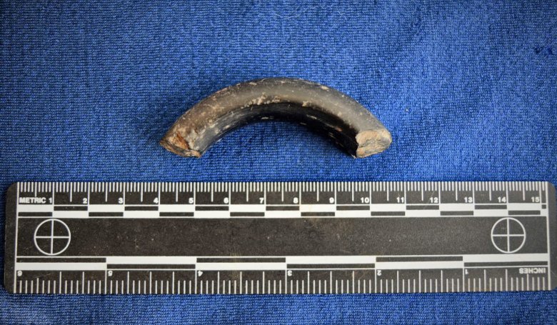
We have also recovered some fragments of lignite bangle, also called cannel coal. These types of accessories are fairly commonly on Iron Age settlement sites.
The centre of the site is dominated by a sub-oval shaped building (Structure B) comprising a curving coursed drystone wall along its northern side, partially contiguous with the south wall of Structure A.
The opposite wall, on the south side of the building, is more sinuous and irregular compared with the north side.
Evidence for internal divisions are evident along the south and east side of the interior of the building, and the arrangement of the structural features in the southeast corner form a small cell, set back from the rest of the interior space.
To date, investigation of this structure has focused on the sampling of possible occupation surfaces. At some stage in the building’s history, it was abandoned, and rubble accumulated across its interior as the walls slowly degraded. At a later stage, some of the rubble was cleared to the edges of the building to accommodate a living area.

A post-setting within the halo of rubble may indicate that this building had a makeshift roof at this stage, perhaps in a lean-to arrangement.
The surface associated with this late period of activity comprised compacted silt with inclusions of crushed and degraded stone and this would have provided a very hardwearing, compacted floor surface. A hearth feature was situated in the centre of this occupation surface and large accumulations of charcoal in the western and southern areas of the occupation surface represent the ash rake out from the fires.
We know that the rubble and infill of this structure was sealed by the same deposits which overlay Structure A. This means that we know the structure had been fully abandoned by the mid-first century BC.
We do not yet have any dates for the occupation of the structure but are hopeful that our intensive sampling strategy from this season will yield viable material for radiocarbon dating, as well as information on the sort of activity taking place around the hearth, and the sort of fuel they were burning.

Previous seasons of excavations encountered peat deposits overlaying a rough flagstone surface directly to the east of the Structure B entrance.
In 2021, we revealed an area of cobbled surface associated with the flagstones, which seems to represent a path or yard area outside the building. This makes a lot of sense, since this seems to have always been a very wet and boggy area of the site. The people who lived here presumably wanted to stabilise their access in and out of the structure.
The south-western extension to the site has revealed the scale of a second large circular building, Structure D. The north curving wall of the building was first encountered at the end of the 2019 excavation. Excavation this year has helped define it and we can see that it is partially contiguous with the south wall of Structure B.
After the excavation of extensive alluvium deposits in the south-west of the site this season, the southern curving wall of Structure D is now also partially revealed. The structure appears to have been a large circular building, whose regularity is particularly striking next to the “squashed” oval shape of Structure B. There was also an east entrance passage, which appears to incorporate modification of earlier structural features. This has been blocked at some stage in the building’s use.

Like Structure B, this building appears to have been mainly infilled with rubble. What is unusual about the infill material is that at it includes very large quantities of burnt stone. Burnt stone is often found in midden and layers around settlement sites, but does the quantity within Structure D indicate more specialised activity on the site? We may find some answers to that question in the analysis of samples from this structure over the coming months, so watch this space.
As with Structure B, we do not have any dates for this structure. We are confident that there will be material within the samples we have taken this year which we can used for radiocarbon dating, and we will keep you posted on progress.
Directly to the east of Structure D are the traces of an earlier feature (Structure C). They represent the fragmentary remains of a structure defined by upright slabs in a right-angled setting, forming a rectangular space. The most intact slab has the rippled surface of a fossilised lake or riverbed.
The outer extent of Structure C is not as well defined as its inner walls, formed as they are from large boulders and disorganised smaller rubble, without apparent faces or coursing. Only limited excavation has been undertaken within this structure so far and the remains appear to have been heavily truncated by later features, including Structure D.

The form of Structure C is reminiscent of the chamber of a stalled burial cairn and may represent evidence for an early prehistoric funerary monument predating the Iron Age occupation on the site.
In summary, the findings from the excavation so far provide us with evidence for a settlement with occupation dating to the Early and Middle Iron Age.
The significance of a non-broch settlement from this period should not be understated, surrounded as it is by broch sites, including the Loch of Yarrow, Thrumster Mains, Tannach Mains and Cairnquoy. The site at the Burn of Swartigill may provide us with a fascinating opportunity to investigate a different, and understudied, aspect of Iron Age society.
In addition to this, it is possible that the Iron Age activity was preceded by an earlier prehistoric feature, which might be tentatively interpreted as a funerary monument.
The possibility that activity at the site stretched back into earlier periods is an exciting development for the project – looking at the relationship that people from later prehistoric societies had with the monuments of their predecessors.
We will be submitting material for radiocarbon dating very soon, so we may have answers to some of those questions about the chronology and longevity of the site in the new year.
In the meantime, we will be continuing to analyse the samples from this year’s excavation, and there are bound to be more finds to report, so check back regularly for updates.

Thanks for sharing the dig details. What an interesting site. In relation to the discovery of a large amount of burnt stone, you might like to look at the paper by Geir Gronnesby on “Hot Rocks: Beer Brewing on Viking and Medieval Age Farms in Trondelag.” Hot rocks have been used to heat hot water and also the mash when brewers used wooden vessels for brewing the ale/beer for many years. They are recognised as ‘brewing stones’ by European archaeologists.
See: https://www.academia.edu/31503395/HOT_ROCKS_BEER_BREWING_ON_VIKING_AND_MEDIEVAL_AGE_FARMS_IN_TR%C3%98NDELAG
For ethnographic research into ancient and traditional mashing in and brewing techniques see ‘Viking Age Brew’ by Mika Laitinen and the work of Lars Marius Garshol: ‘Historical Brewing Techniques. Both are renowned brewing historians and Mika is a master brewer. Their blogs are BrewingNordic and Larsblog.
See: https://www.brewingnordic.com/books/
and https://www.garshol.priv.no/download/historical-tech/
I think you may have excavated an Iron Age brewhouse at Swartigill. The location beside the stream, the large amount of burnt stone, the flagged floor and drain and more indicate that one of the buildings here was a brew house. Brewing is a very messy business and every brewery needs a drain.
with best wishes
Merryn Dineley
Fascinating details. Looking forward to any more updates with the further materials to be radiocarbon dated.