(Cutter’s Tuo)

| Type: | Orkney-Cromarty. Round cairn. Probably tripartite or stalled chamber. |
| Location: | Map |
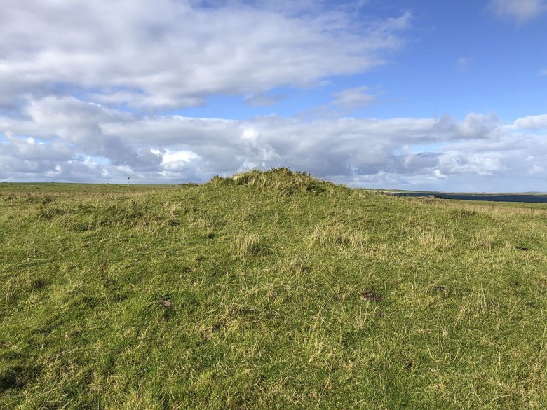
| Notes: | A circular cairn, with a diameter of c13.5m, on a well-defined platform c22 metres in diameter. In 1927, the cairn was recorded as “an almost perfect cone” standing over two metres high and with a diameter of c18 metres [1]. At this time it still served as a fisherman’s mark. By 1982, however, it had been reduced to 1.2m – although the outer section and platform showed little sign of disturbance [2]. The addition of a stone marker cairn on top suggests its role as a fisherman’s navigation mark continued. This navigation cairn is now gone, although evidence of it remains clearly visible on top of the mound. [3] In 1982, the stumps of two pairs of orthostats, set 2.7m apart, were visible above the turf suggesting a chamber aligned SSE-NNW. A fifth stone on the cairn’s western side was not considered to be part of this chamber. No evidence of these orthostats is now visible, perhaps covered by the remains of the now gone navigation cairn. [3] In 1970, islanders remembered that “several years ago” there was a short stretch of drystone walling exposed in the western arc of the cairn. This was perhaps an exposed section of a surrounding retaining wall. Traces of a semi-circular line of stones along the cairn’s western edge may be the remains of this walling. [3] Update: May 2023 Preliminary results of geophysical scans here. |
| Links: | Canmore |
| References: | [1] Marwick, H. (1927) Antiquarian notes on Stronsay. In Proceedings of the Orkney Antiquarian Society Volume 5. [2] Davidson, J. L. & Henshall, A. S. (1989). The Chambered Cairns of Orkney. Edinburgh: Edinburgh University Press. [3] UHI Archaeology Institute site visit. September 12, 2022. |